
A red route clearway is proposed on about two miles of Lansdown Road, plus 19 more parking changes in north west Bath. Objections close on 15 October.
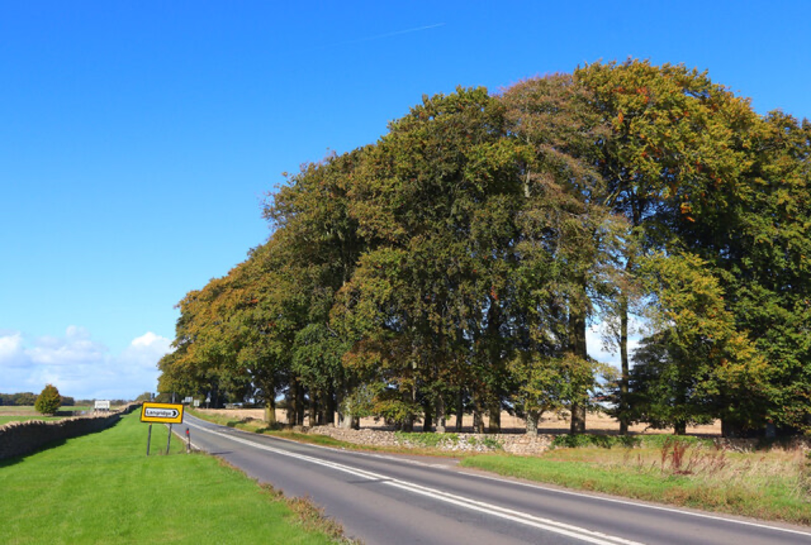
Bath and North East Somerset Council wants to make Lansdown Road a red route clearway, where no vehicle may stop at any time. The proposal covers the open stretch across the top of Lansdown, and it is out for objections until 15 October.
It is one of 20 parking changes the council published on 24 September for the north west of the city, under draft traffic order 26-062 (B&NES notice). Nothing has been decided yet. This is the stage where residents can still change it.
What a red route clearway would mean
The order would put in place no stopping, no waiting and no loading at any time on the lengths of Lansdown Road it covers. That is stricter than a double yellow line, which normally still lets a driver stop to load or to drop someone off.
The council’s own maps show the red lines running through ten of the order’s 23 map sheets. They start in open country at the northern end of Lansdown, run south past the Charlcombe Inn and end near Lansdown Cemetery, beside Beckford’s Tower. Measured from the map sheets’ grid references, that is roughly two miles of road (26-062 schedule maps, PDF).
The council gives one reason for it. The red route “was requested by the Traffic Management Team to prevent obstruction of this key route due to parked vehicles” (officer decision report, DOCX). The documents do not say where or when the parking happens, and they do not include any count of obstructions.
Separately, the same order adds ordinary no parking at any time lines on another part of Lansdown Road. The report says a ward councillor asked for those “to prevent obstruction of and access to the highway due to parked vehicles”.
The other 19 changes, street by street
The report lists each plan and who asked for it. Two plans, numbers 12 and 15, were dropped before the order was advertised.
| Where | Change | Asked for by | Why, in the council’s words |
|---|---|---|---|
| High Street and Southlands, Weston | No parking at any time | Council traffic team | Improve visibility around the junction |
| Yomede Park, Newbridge | No parking at any time | Ward councillor | Prevent obstruction around the junction |
| High Street, Weston | Longer yellow lines, shorter parking bay | Ward councillors | Improve access to Belton Court |
| Chandler Close, Weston | Advisory disabled bays become enforceable blue badge bays | Parking Services | Allow enforcement |
| Alpine Gardens, Walcot | Longer yellow lines, parking bay removed | Ward councillor | Narrow road |
| Greenbank Gardens, Upper Weston | No parking at any time | Ward councillors | Cars parked on the white keep clear markings |
| Southlands, Upper Weston (two places) | No parking at any time | Ward councillors | Obstruction at a junction and a bend |
| Foxcombe Road, Newbridge | Disabled bay removed, shared permit and 1-hour bay extended | Ward councillor | The disabled bay is no longer needed |
| Homelea Park East, Newbridge | No parking at any time | Ward councillor | Obstruction at a junction and a bend |
| Cranwells Park | No parking 10am to 4pm weekdays, plus 3-hour bays | Ward members and cabinet member | Remove commuter parking |
| Sion Road, Lansdown | No parking at any time | Ward councillor | Give drivers room to pass |
| Sion Hill, Lansdown | Longer yellow lines, smaller permit bay | Ward councillor | Obstruction when turning out of Sion Road |
| Cavendish Road, Lansdown | Longer yellow lines, smaller permit bays | Ward councillor | Obstruction and visibility |
| Brookfield Park, Weston | No parking at any time | Ward councillor | Obstruction and access |
| Southlands, Weston | Enforceable blue badge bay | Ward councillor | The advisory bay is misused |
| Lower Bristol Road | No waiting or loading at any time, plus loading-only bays | Council traffic team | Obstruction, and to provide loading |
| Newbridge Road, Newbridge | Enforceable blue badge bay | Ward councillor | The advisory bay is misused |
The table is shortened from the report’s own wording. The full plan list is in the officer decision report linked above.
Cranwells Park: the change most likely to be felt day to day
The biggest change to how people park is at Cranwells Park. The order would bring in no parking between 10am and 4pm, Monday to Friday, on some lengths, and 3-hour limited waiting bays over the same hours on others.
The report says the ward members and the cabinet member asked for it “to improve on-street parking provision for local residents and remove the commuter parking issue which leads to obstruction of the highway”. If you park there for a working day, that would end once the order is made.
Most of the plans came from councillors, who then said nothing
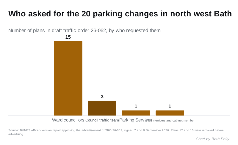
Fifteen of the 20 plans were requested by local ward councillors, according to the report. Three came from the council’s traffic management team, one from Parking Services, and one from ward members together with the cabinet member.
Yet in the informal consultation before advertising, all ten ward councillors for Lansdown, Newbridge, Walcot, Weston and Westmoreland are recorded as “No comment”. So are the emergency services, the Road Haulage Association, Logistics UK and the council’s own parking and waste teams. The only written views came from two places:
- Avon and Somerset’s Chief Constable noted that the council, not the police, enforces waiting restrictions. The force asked the council to think about where displaced parking would go.
- Cllr Lucy Hodge, who is a Lansdown ward councillor and also the cabinet member for sustainable transport delivery, said in that second role “Please proceed to public consultation.”
The traffic management and network manager recommended advertising on 7 September, and the head of highways delivery approved it on 8 September. The work is funded from the council’s capital Area Parking Review budget.
What it means for you
- If you drive Lansdown Road, including to the Lansdown park and ride, you would no longer be able to stop anywhere on the covered stretch, even briefly. Check the maps for where the red lines start and end.
- If you park in Cranwells Park on weekdays, plan for a 3-hour limit or no parking at all between 10am and 4pm.
- If you hold a blue badge, advisory disabled bays in Chandler Close, Southlands and Newbridge Road would become enforceable bays, so misuse can be ticketed. The advisory bay in Foxcombe Road would go.
- Every change is still a proposal. Objections must give the grounds for them and reach the council by 15 October 2026.
How to object or comment
Quote reference 26-062. You can respond in three ways, according to the council’s notice:
- online at consultation.appyway.com/bath-and-north-east-somerset, choosing consultation 26-062 on the left and using the feedback form
- by email to TROs@bathnes.gov.uk
- in writing to the Traffic Management Team, Lewis House, Manvers Street, Bath BA1 1JG
Paper copies of the plans can be seen at the One Stop Shops in Manvers Street, Bath and The Hollies, Midsomer Norton, and at Keynsham Civic Centre. The council warns that representations, with names and addresses, may be considered in public.
For the roads that are actually closed this week, see our Bath roadworks page. For car parks and charges, see parking in Bath.
Sources
- B&NES traffic order notice 26-062, 24 September 2026, also on the Public Notice Portal, for the list of changes, the 15 October deadline and how to respond.
- Officer decision report approving advertisement of TRO 26-062 (DOCX) for each plan, who requested it and why, the consultation responses, the funding and the 7 and 8 September sign-off.
- 26-062 schedule maps (PDF) for the extent of the Lansdown Road red route.
- Statement of reasons for 26-062 (PDF) for the legal grounds the council relies on.
Have your say